MotoPath
MotoSpeed

The digital dashboard
for your motorcycle.

The only dashboard that shows your lean angle in real time. Plus track-grade telemetry, GPS speed, voice navigation and speed-camera alerts. On iPhone and Android.

Discover more

How MotoSpeed works

Dashboard, navigation and telemetry, explained in two minutes.

Everything you need. Nothing you don’t.

Designed by riders, for riders.

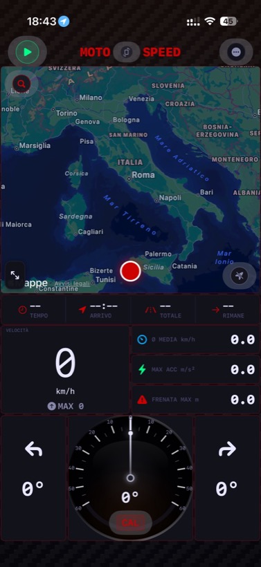
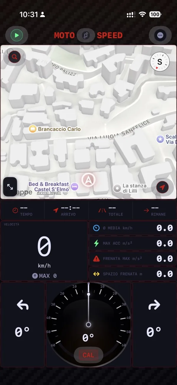
MotoSpeed dashboard: map, speedometer and real-time lean angle

The real-time dashboard

Everything that matters at a glance, while you ride. The digital dashboard your speedo can’t give you.

  • Accurate GPS speed, more reliable than the speedometer
  • Real-time lean angle, with left and right maximums
  • Acceleration, braking and estimated braking distance
  • Built-in map always in view + Apple Watch companion
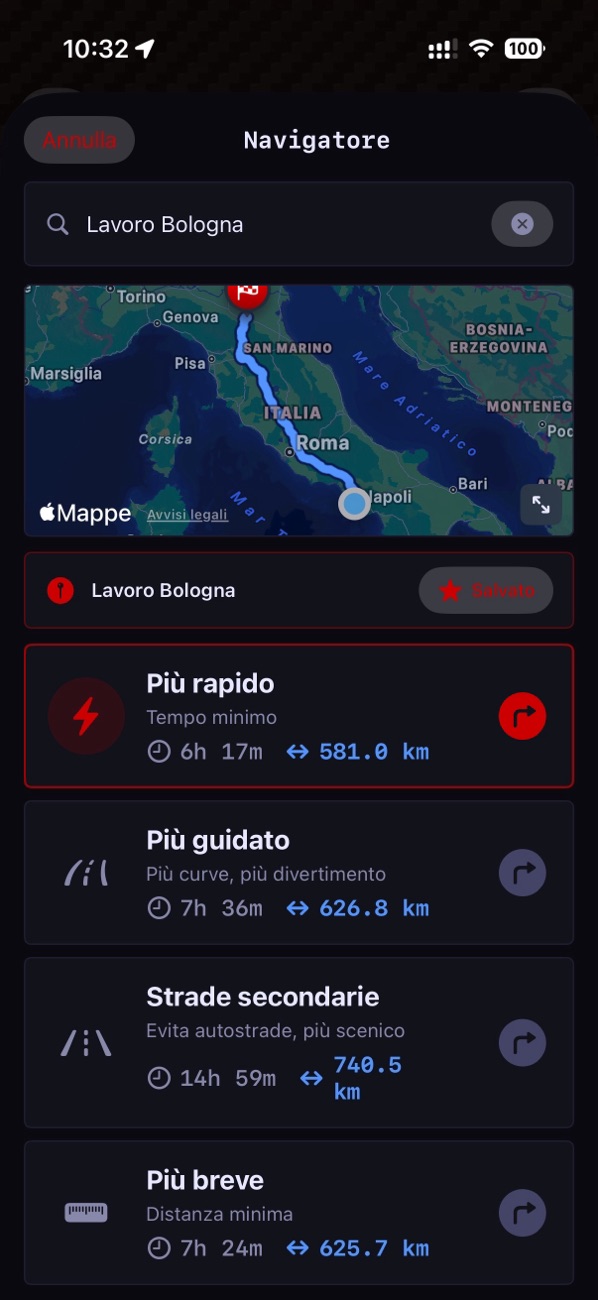
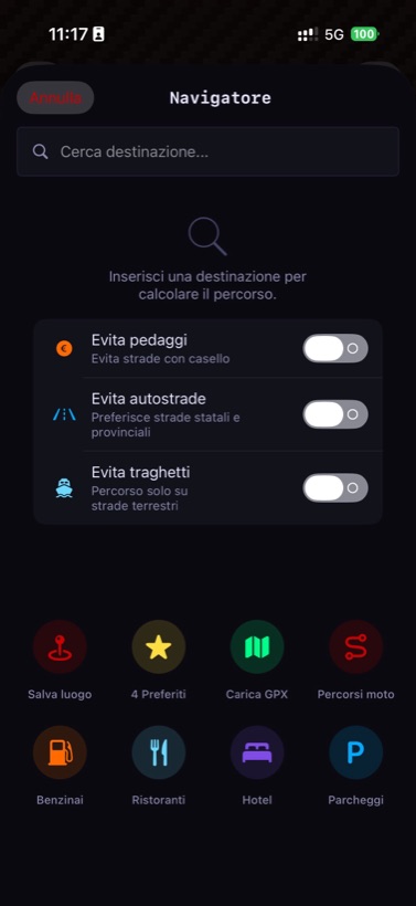
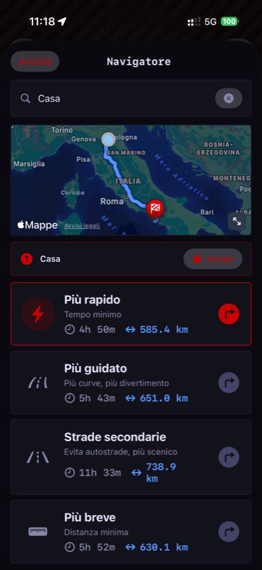
MotoSpeed navigation screen with motorcycle route options

Turn-by-turn navigation

Rally co-driver style voice instructions, made for riders wearing a helmet.

  • Choose between fastest, most fun or back roads
  • Visual and audio speed-camera alerts, three warning levels
  • Automatic 2D/3D transition near manoeuvres
  • Realistic arrival time, automatic rerouting
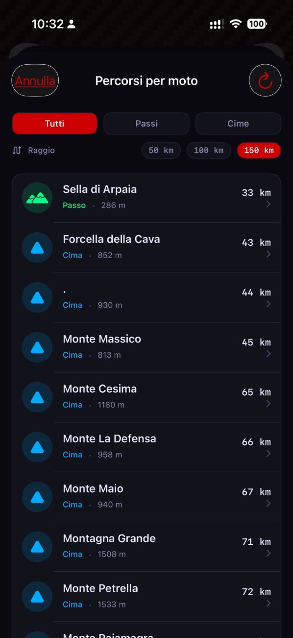
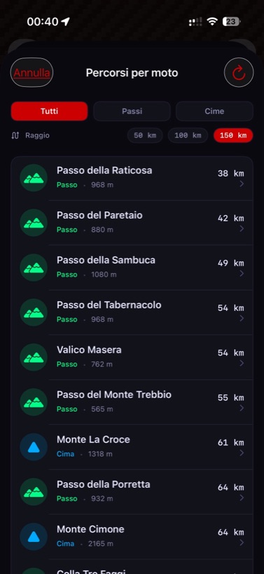
List of motorcycle routes: mountain passes and scenic peaks

Motorcycle routes: passes & peaks

The best mountain passes and scenic peaks near you, discovered automatically.

  • OpenStreetMap data, sorted by distance from you
  • Filter by passes or scenic peaks
  • Select and start navigation with one tap
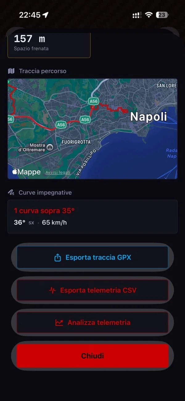
MotoSpeed session summary with braking distance, route trace and significant corners

Telemetry — session summary

At the end of every ride, the full picture: braking distance, route trace, challenging corners and GPX/CSV export. Your data, on your phone, no cloud.

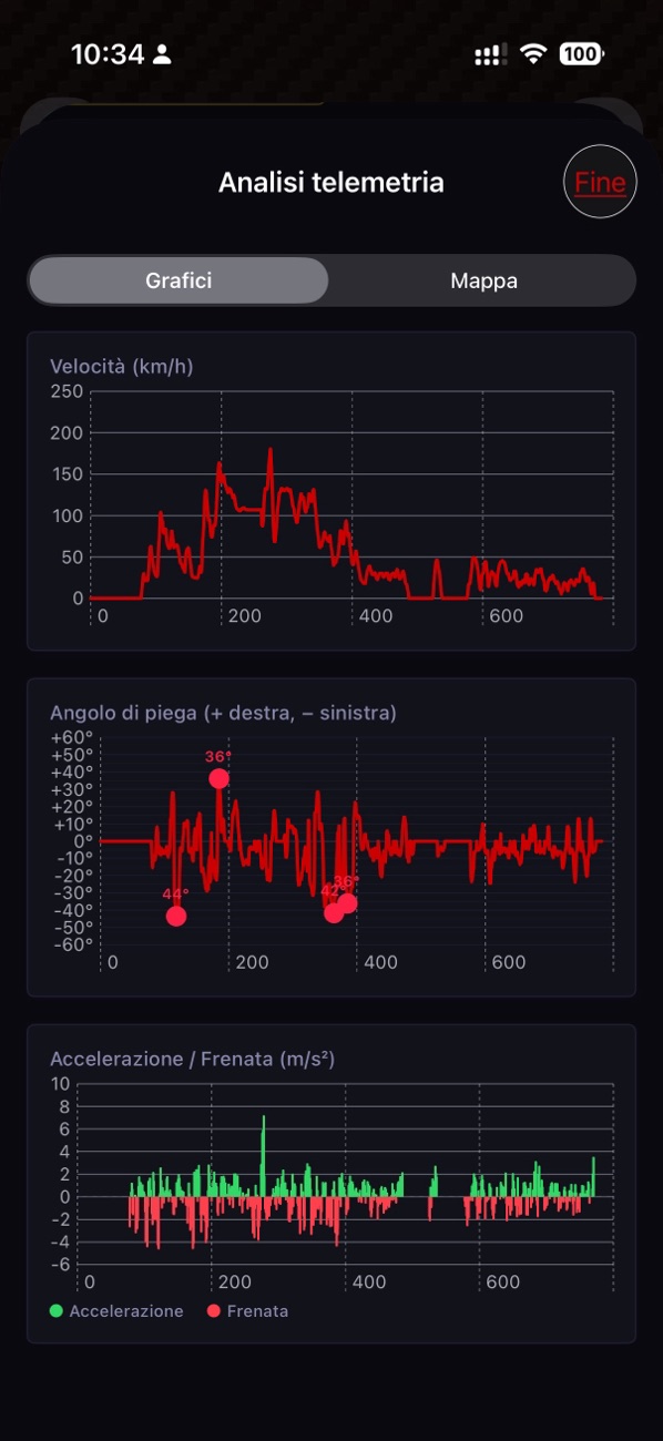
MotoSpeed Telemetry Analysis tab with speed, lean angle, acceleration and braking charts

Telemetry — graphical analysis

Three stacked charts — speed, lean angle, acceleration and braking — with Photos-style pinch-to-zoom to analyse every detail of the ride.

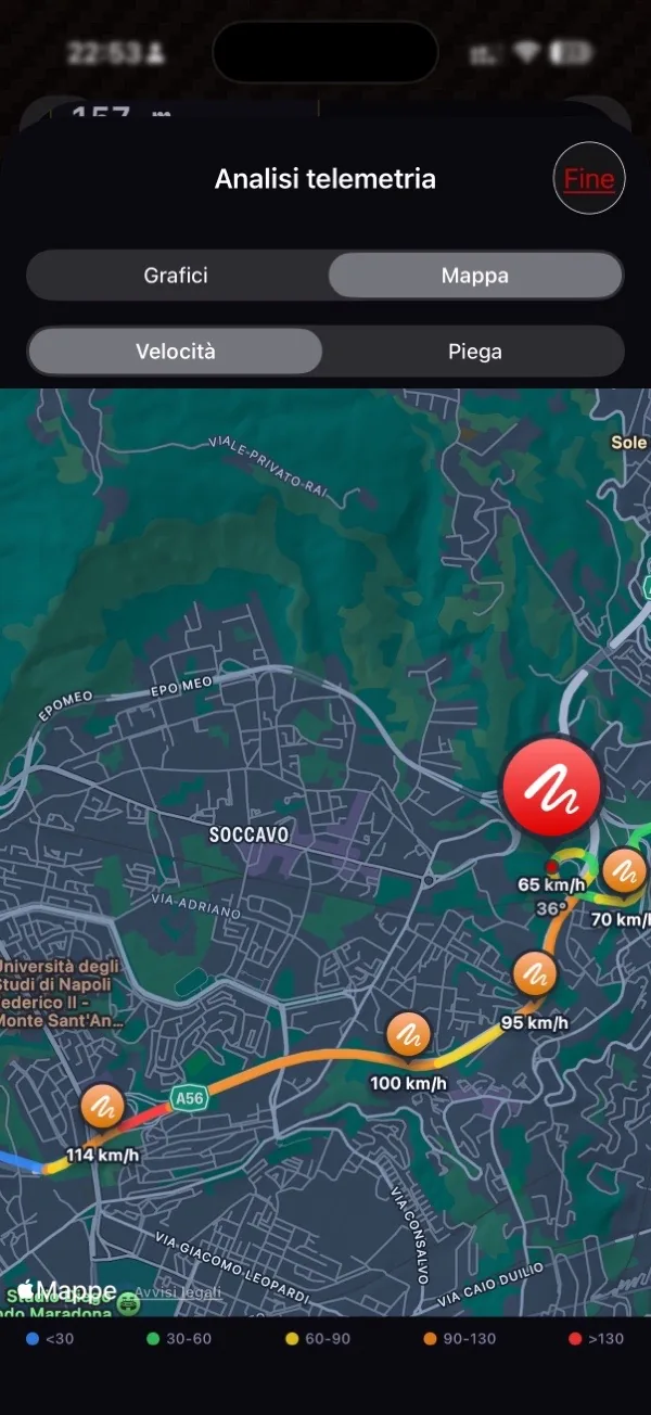
MotoSpeed map with polyline coloured by speed

Speed-coloured map

The ride trace coloured across five levels: from blue (slow) to red (over 130 km/h). See at a glance where you pushed.

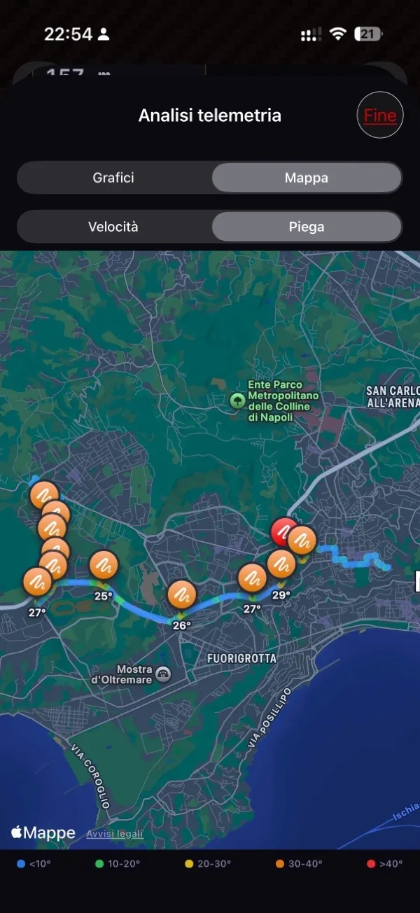
MotoSpeed map with polyline coloured by lean angle and significant corner markers

Lean-angle coloured map

See at a glance where you leaned the most: the trace coloured by lean, with a marker for every corner above 25°.

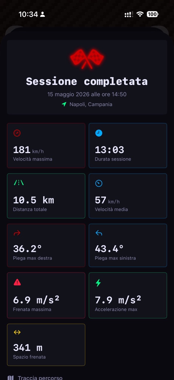
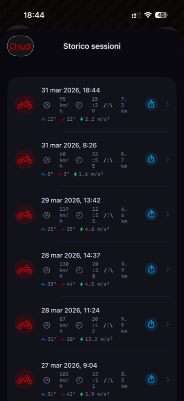
Summary of a completed session with all the statistics

Sessions & history

Every ride saved in full. Relive your rides and track your progress over time.

  • Route, max and average speed, duration and distance
  • Max lean left and right, braking and braking distance
  • Full history of every session, always with you
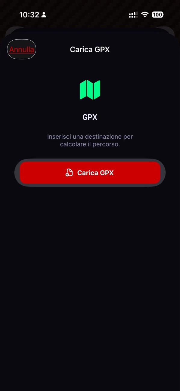
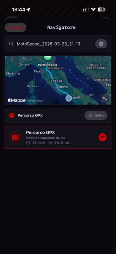
Screen for importing a GPX track

GPX import & export

Bring along routes built with the Route Planner or shared by other riders.

  • Import multi-stop .gpx tracks
  • Export your rides and telemetry to analyse or share them
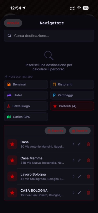
  • Save your favourite places and find them on every ride
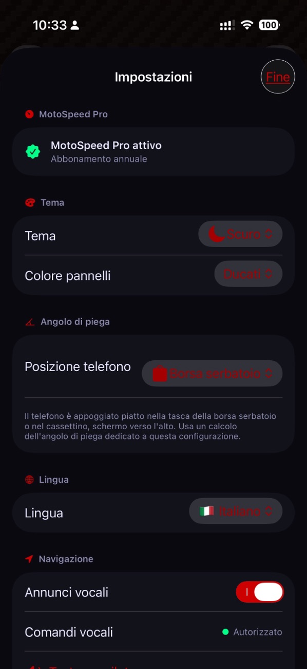
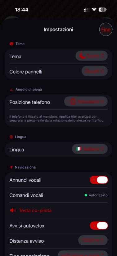
MotoSpeed Settings screen: theme, panel colour, phone position, language and announcement voice

Settings — appearance and mounting

Theme, panel colour, phone position (frame, handlebar or tank bag), language and announcement voice: the app adapts to your bike and your style.

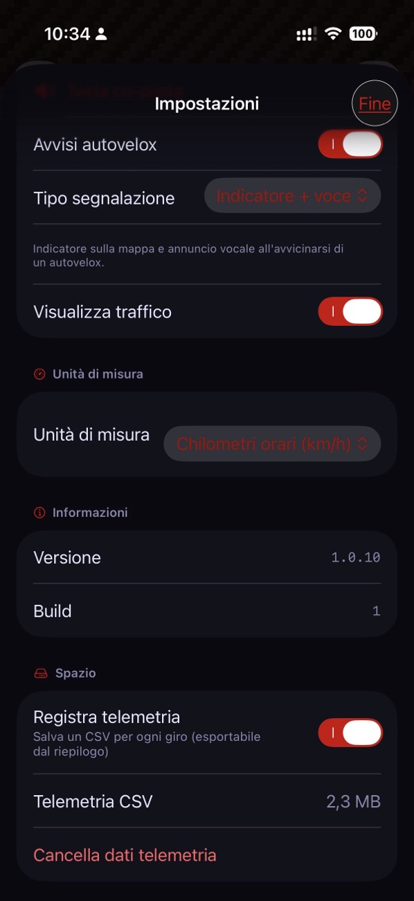
MotoSpeed Settings screen: speed-camera alerts, traffic, units and telemetry management

Settings — alerts and telemetry

Speed-camera alerts, traffic on the map, units of measurement and telemetry recording management: everything under control, one tap away.

Why MotoSpeed?

Every detail designed for those who live on two wheels every day.

01

Real speed, not estimated

Your motorcycle’s speedo overestimates speed by law, often by 5–10%. MotoSpeed uses GPS signal to show your actual speed in real time with continuous updates. Maximum speed, average speed and acceleration are automatically recorded for every session — so you always know how you rode.

02

Discover how far your bike leans

Lean angle is calculated in real time using the phone’s accelerometer and gyroscope. Advanced filters eliminate sensor noise and compensate for handlebar rotation at low speed — no ghost lean angles during manoeuvring. Left and right maximums are saved for every ride: challenge yourself corner by corner and track your progress.

For best accuracy: mount your phone on the frame (triple clamp, tank, fork). Alternatively mount it on the handlebars, but select “Handlebars” in settings and calibrate before you ride. Calibration: a single tap on the CAL button while stationary.
03

Rally co-driver voice navigation

Set your destination, choose a route and go. Voice instructions guide you without needing to look at the screen: turns, roundabouts, motorway exits — all announced at the right moment, with timing calibrated to your speed and calculated along the actual route, not as the crow flies.

Zoom adapts automatically to your speed: tighter in town, wider on the motorway. The vehicle indicator tilts smoothly in corners, giving you a natural sense of direction. The map switches from 2D to 3D near manoeuvres for the best perspective.

Quick access to petrol stations, restaurants, hotels and car parks along your route.

04

GPX routes: import, export, share

MotoSpeed supports the GPX format, the universal standard for GPS tracks. You can import itineraries created by other riders — downloaded from touring sites, forums or communities — and follow them directly with voice navigation, just as if they were routes calculated by the app.

You can also export your recorded sessions as GPX files: share them with friends, publish them online, or archive them for review in any mapping software. Import is done directly from the app via the “Load GPX” button in the Navigator.

Typical use: download an alpine pass track from a motorcycle touring site, import it into MotoSpeed and let it guide you corner by corner with voice instructions. On the way back, export your session and compare the actual route with the planned one.
05

Save your places, take them anywhere

Found a hidden mountain refuge, a breathtaking viewpoint or an off-the-beaten-track trattoria? One tap on “Save place” and the GPS position is saved to your favourites with the name you choose. Next time just select it from the list to start navigation directly.

You can export all your saved places to a file and import them on a new phone — so you lose nothing when you change device. Save the file to iCloud, Google Drive or wherever you like: your places will always be safe.

Tip: before changing phone, export your favourites from the app. On the new device install MotoSpeed and use “Import” to recover all your places with one tap.
06

Speed cameras: knowing where they really are

Three progressive alert levels — visual, approaching and imminent — with automatic voice warning. The smart filter cross-references your position, direction of travel and active route to ignore cameras on parallel roads, flyovers and opposite carriageways. Only alerts that matter, zero unnecessary distractions.

Database updated with community reports: confirm or deny cameras reported by other users. Report mobile speed cameras with one tap.

07

Every ride is recorded

MotoSpeed automatically saves all sessions with the complete route on the map, duration, distance, maximum and average speed, left and right maximum lean angles, acceleration and deceleration. Browse your history to relive your best rides and watch how your riding style evolves.

08

Apple Watch on your wrist

The Apple Watch companion app shows speed and lean angle directly on your wrist. You can also control the app from your watch: start and stop sessions, calibrate the lean angle and access settings. Customise colour, units and language directly from the Watch.
09

Designed for safety

The high-contrast dark interface is readable even in full sunlight. Operations that require attention — calibration, settings, history — are locked while the bike is moving. Voice commands let you mute, repeat the last announcement or ask about the next corner without taking your hands off the handlebars. Available in 5 languages: Italian, English, Spanish, German and French.

10

Motorcycle routes: passes and peaks at your fingertips

MotoSpeed queries OpenStreetMap in real time to find mountain passes and scenic peaks reachable by road within your chosen radius — 50, 100 or 150 km from your current position. Results are sorted by distance and enriched with altitude and area name.

Filter by type (all, passes only, peaks only), select a destination and the app automatically calculates Valhalla routes optimised for motorcycles. From that moment, voice navigation guides you all the way to the top — without opening any other app.

Tip: use the “150 km” filter during evening planning to discover passes you didn’t know existed within two hours of home. OpenStreetMap data is continuously updated by the community.

See MotoSpeed in action

Dark interface optimised for riding, readable even in full sunlight.

Main dashboard Dashboard
Navigation Navigation
Destination search Destination search
Route alternatives Route alternatives
GPX route GPX Route
Session history History
Settings Settings
MotoSpeed Pro MotoSpeed Pro
Motorcycle routes Motorcycle routes

What riders say

A real-time inclinometer like this doesn’t exist anywhere else yet. All my encouragement to the developer!
— App Store review · France

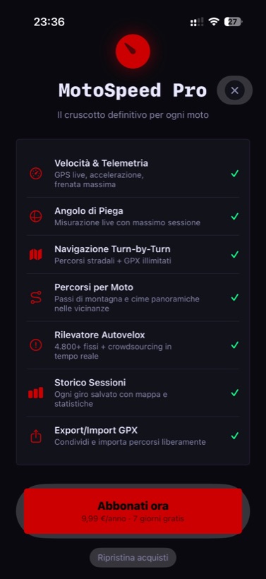
Try it free for 7 days. Then you choose.

PRO

MotoSpeed Pro

€19,99/year
7-day free trial
  • Real-time GPS speed
  • Lean angle
  • Turn-by-turn navigation
  • Speed camera alerts
  • Session history and telemetry analysis
  • Motorcycle routes (passes & peaks)
  • Unlimited saved places, GPX import/export and favourites
  • Apple Watch and CarPlay

7-day Pass

€5,99 one-time
  • Every Pro feature for 7 days
  • No automatic renewal
  • Perfect for a weekend or a trip
  • Buy it again only when you need it

Ready to ride?

MotoSpeed is available on the App Store. Download it now!

Download on the App Store Get it on Google Play
Read the User Guide
Support